Travel to west-central Africa to a hot and humid land of rainforests, swamps, mountains and savannas. With the Congo River bordering its eastern side, this oil-rich nation is also home to an abundance of wildlife, but political instability has paid a price. Our printable resources below can help to test your findings.
A Little Geography…
- The Republic of the Congo and the Democratic Republic of the Congo have similar names and are found next to each other, but they are different countries.
- The Republic of the Congo lies on both sides of the equator. It borders five countries – Gabon, Cameroon, the Central African Republic, the Democratic Republic of the Congo, and Angola – and also shares a small border with the Atlantic Ocean.
- The country has a population of about 5 million people, living in an area of around 342,000 square kilometres. Most people live in and around the capital city Brazzaville, in the south. The official language is French but other African languages are also spoken.
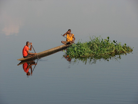
- There are rainforests and swamps in the north, grasslands in the centre and mountains in the southwest. The highest peak is Mount Berongou at 903 metres. The Congo River makes up much of the country’s eastern border.
- Most people in the Republic of the Congo are farmers growing what they need to survive. The country’s main source of income, however, is oil. Other main exports include wood, sugar, cocoa and coffee.
A Little History…
- The Congo River has been an important trade route for centuries. Before the Europeans arrived in 1483, an ethnic group called Kongo ruled the land. In 1880, France took control of the region and later combined it with areas such as Gabon and Chad to create French Equatorial Africa (AEF).
- In 1958, the Republic of the Congo was created and the country gained independence from France in 1960. But the decades that followed brought violence and instability as different groups tried to take control. A four-month civil war broke out in 1997. Peace talks have helped to bring stability back to the region, but nearly half the population are living in poverty.
And Some Interesting Facts…
- The Republic of the Congo has an abundance of wildlife, including lowland gorillas, forest elephants and chimpanzees in the swampy forests, antelope and cheetahs roaming the savannas, and rhinoceroses and giraffes on the plateaus. Sea turtles can also be seen laying eggs on the coast. The country’s national symbols are the lion and the elephant, although lions are now scarce.
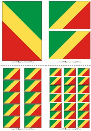
- The country’s flag has a yellow diagonal band, with green and red on either side. The green represents the forests and farming, the yellow stands for friendship and the red is said to symbolise the struggle for independence.
- As well as having a similar name to the Democratic Republic of the Congo, the two countries share common dance styles. The soukous and kwassa kwassa are fast-paced, hip-shaking dances that are sure to get your toes tapping!
The Congo Flag
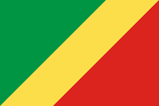
The national flag of the Republic of the Congo has a central yellow diagonal band with a green triangle above and a red triangle below. The green represents the agriculture and forests of the Congo, and the yellow represents "friendship and nobility".
Our Congo Resources
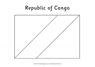
Here is a colouring page for the Congo flag. Grab your red, green and yellow pencils and turn the printer on!
There are four pages in this printable, each with a different size of Congo flag on it, ranging from one large flag on a page to 21 tiny ones...
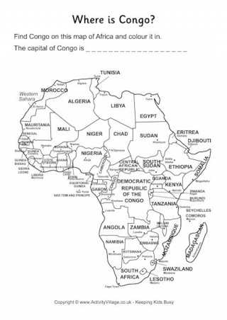
Can the children find where Congo is on this map of Africa, then colour it in (and can they remember the name of the capital city too?). We have two versions, one with other African countries labelled, and one with a blank map of Africa for an extra challenge.
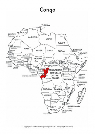
This useful printable shows where the Congo is located on a map of Africa, with all other African countries labeled too.
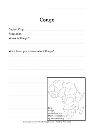
This worksheet is great for the kids to record some information they have learned about the Congo. There are a couple of fact-finding questions, space to write about what they have learned and a map where they can show the location of the country and capital city.