Printable Maps of North America


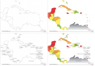
Download printable maps of North America showing just the outline of the continent, the countries, or the countries and capitals. All 3 types are available in either black and white or colour, too.

Please note that these are simplified maps only and are not intended to be accurate!

PDF iconAll maps of North America - Log in or Become a Member to download
PDF iconMaps of North America blank black and white - Log in or Become a Member to download
PDF iconMaps of North America blank colour - Log in or Become a Member to download
PDF iconMaps of North America with countries black and white - Log in or Become a Member to download
PDF iconMaps of North America with countries colour - Log in or Become a Member to download
PDF iconMaps of North America with countries and capitals black and white - Log in or Become a Member to download
PDF iconMaps of North America with countries and capitals colour - Log in or Become a Member to download
Printable maps of North America


Become a Member to access 39,201 printables!