Find out about Libya, on the north coast of Africa. As the continent’s fourth-largest country, Libya is a nation of immense oil wealth, but this dry, barren land has also faced years of political instability. Use our collection of resources below to find out more.
A Little Geography…
- Libya borders Tunisia, Algeria, Niger, Chad, Sudan, Egypt and the Mediterranean Sea to the north. The capital, Tripoli, is a major shipping port.
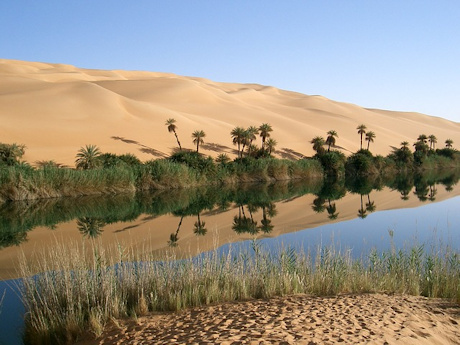
- The country covers the northern and eastern part of the Sahara Desert. The land is so dry that it is difficult to grow food. Some parts haven’t seen rainfall for decades. This means Libya has to import about 75 percent of its food.
- The country has a low population density – around 7 million people living in an area of about 1.7 million square kilometres. Most people live in coastal cities in the north. The official language is Arabic, although English and Italian are also spoken.
- Up to 97% of Libya’s exports are oil, but the country also has deposits of gas and iron. Many people work in the service sector (government, healthcare and banking), while those that farm, grow wheat, barley, olives and potatoes, or raise sheep and goats.
A Little History…
- The area that is now Libya was conquered by the Arabs in the 7th Century, when many local people converted to Islam. Later, in the 16th Century, the Turks took it over as part of the Ottoman Empire.
- In 1911, the area became an Italian colony, and was named Libya in 1934. But after World War II, the country was divided between France and Britain.
- Libya declared independence in 1951, and oil was discovered seven years later. This brought immense wealth, but it mainly went to the people in power.
- In 1969, Muammar Gaddafi took over the government. He ruled for 42 years, but was overthrown in 2011 which kick-started a civil war. Political disagreements continue as the nation struggles to secure a democracy.
And Some Interesting Facts…
- Libya is home to an abundance of desert animals, including rodents, foxes, jackals and hyenas. Eagles, hawks and vultures survey the skies.
- 1984 saw the start of the world’s largest irrigation project, when Libya started building an almost 4,000 km-long pipeline to bring fresh water to its cities. This water came from a reserve found under the Sahara Desert. The pipeline is known as the Great Man-Made River.
- When Libya declared independence in 1951, two bands (of red and green) were added to its flag. The red represents the struggle for independence while the green stands for freedom. The original crescent and star represent Islam.
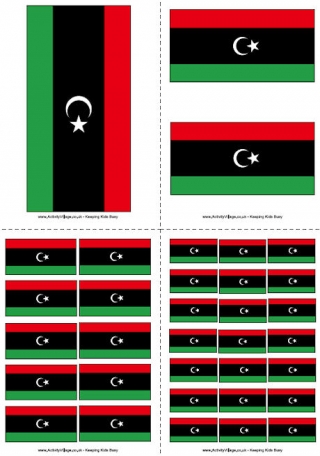
The Libyan Flag

The Libyan flag consists of a white star and crescent on a black band, with a red band above and green band below. The flag of Libya was introduced in 1951 following the creation of the Kingdom of Libya.
Our Libya Resources
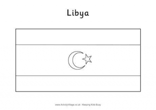
Here is a colouring flag for Libya. Leave the crescent moon and star white, then colour the stripes red, black and green from top to bottom.
The PDF file below has four different sizes of the Libya flag ready for printing.
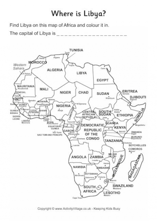
Help children locate, and then learn the location of, Libya, with these fun location worksheets.
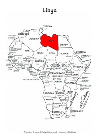
This outline map of Africa shows Libya's position at the top of the continent very clearly.
What do the kids know about Libya? Find out with the help of this worksheet.