Printable Maps of the United States


These useful maps are a great way to learn the states of the United States of America - and their relative position and size. Choose from black and white or colour, and blank or labelled versions, or download them all. Outlines have been simplified and should not be assumed to be 100% accurate.
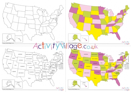
PDF iconAll maps of the United States - Log in or Become a Member to download
PDF iconMap of the United States blank black and white - Log in or Become a Member to download
PDF iconMap of the United States blank colour - Log in or Become a Member to download
PDF iconMap of the United States with states black and white - Log in or Become a Member to download
PDF iconMap of the United States with states colour - Log in or Become a Member to download
Printable Maps of the United States


Become a Member to access 39,201 printables!